Show the terrain, the sensor, the product, and the decision in one defensible story. Field production, approved screen capture, founder narrative, and launch assets for mapping and autonomous-system teams.
FAA Part 107Field-production experienceTechnical product captureClient-approved claimsCalifornia + travel
Adjacent field proof
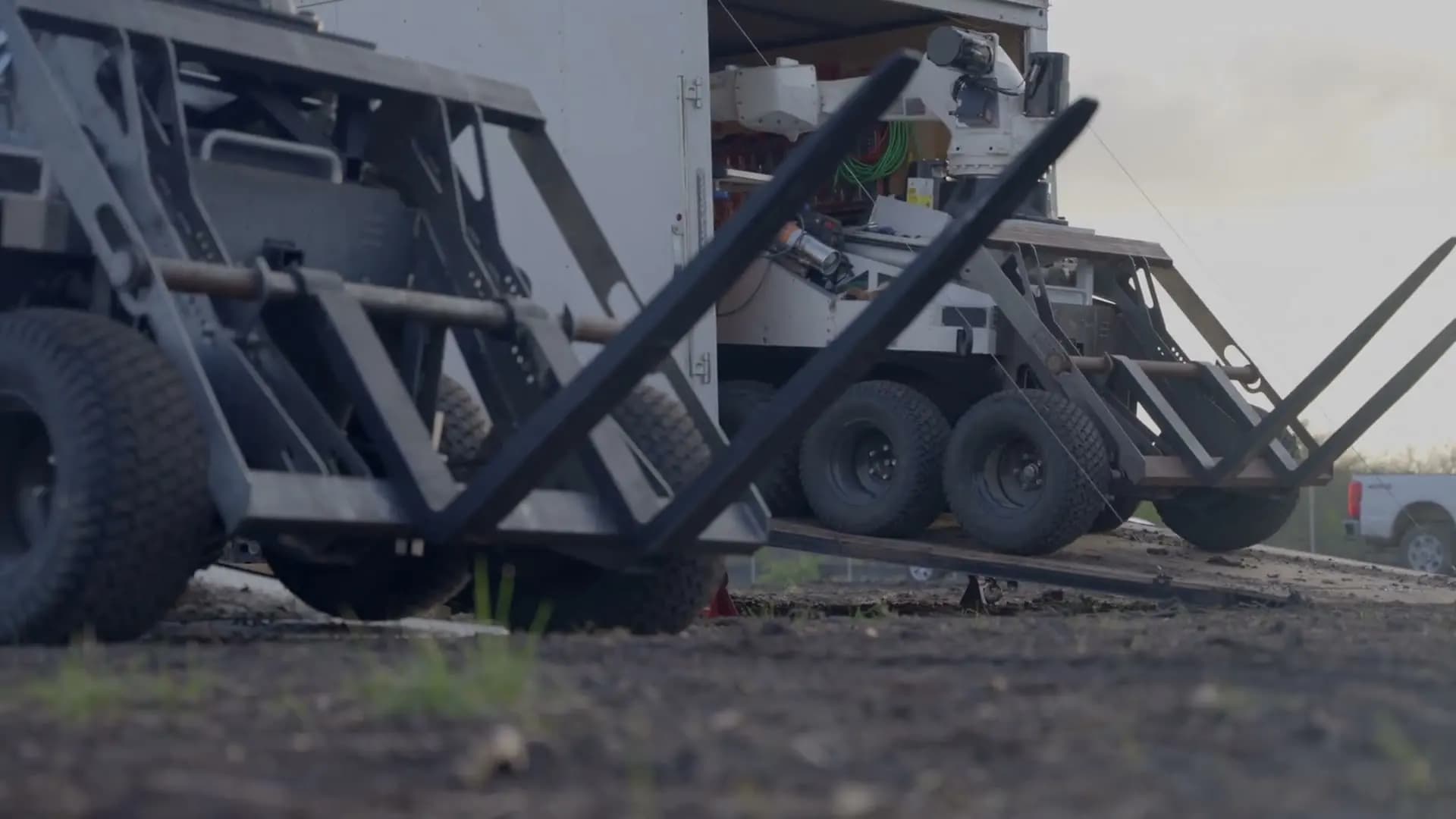
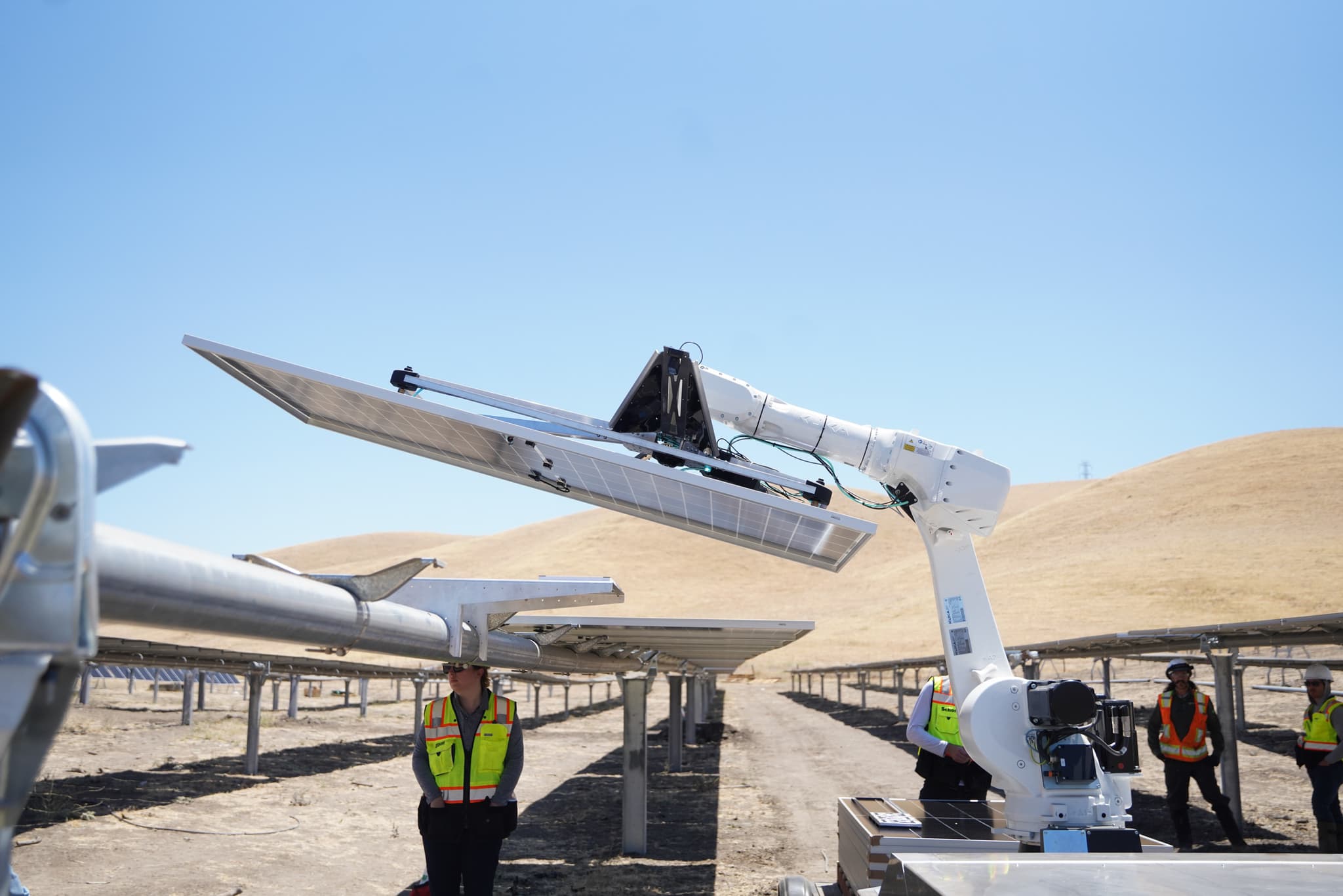
The Cosmic‑1 launch film.
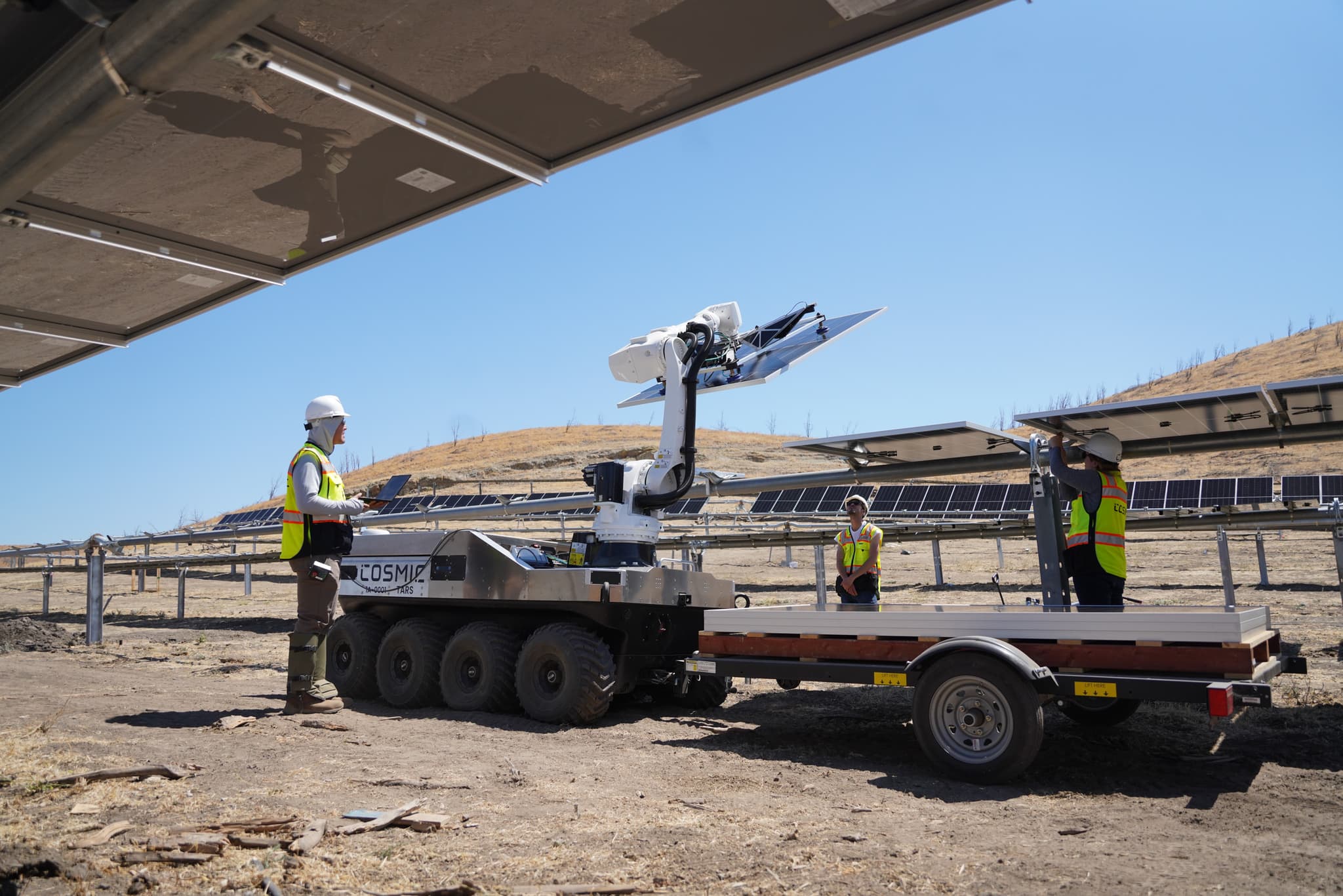
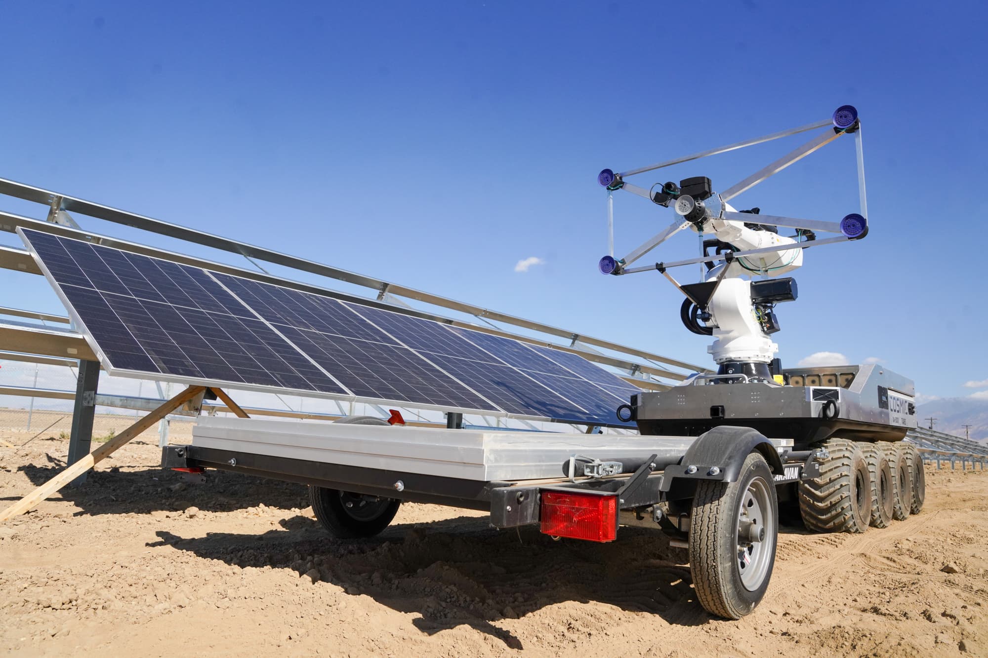
Our public reference for filming autonomous hardware in its real operating environment. Cosmic Robotics is a robotics and solar-construction client; it is not presented as a geospatial client.
Production across the US, with experience in Germany. We scope locations, crew, and post-production around the project.
Launch film + supporting assets
For a product debut, research demo, funding announcement, or first customer deployment. Start with the audience and one clear product story.
The scope
A main film with agreed cutdowns, captioned versions, press b-roll, stills, and presentation loops. Deliverables and revision rounds are written into the proposal.
The schedule
We work backward from your launch date through script approval, access, filming, editing, and final review. Location access and technical review set the critical dates.
The budget
Shoot days, locations, crew, talent, product capture, motion design, and version count determine the quote. Existing footage can reduce new capture.
For teams with footage to use and progress to share. Turn demonstrations, founder interviews, and field work into a consistent stream of finished content.
Start with your library
Send sample footage, transcripts if available, brand assets and examples of the edits you need. We check image and sound quality, product accuracy, usage permissions and gaps before recommending edits or a new shoot.
Agree on a cadence
Agree a monthly or campaign-based batch: number and length of edits, captions, aspect ratios, review rounds and delivery dates. A named reviewer consolidates feedback. Filming and substantial new animation are quoted separately.
Keep it current
A named client reviewer confirms technical claims before release. New deployments can add footage for future launch, sales, recruiting, and website uses.
Y Combinator LinkedIn audience the launch film was published to
175
Stills in the Southern Texas photography library
Updated 5 min read
Geospatial products become useful when information about a real place changes a real decision. A strong film therefore cannot stop at a map animation or dashboard tour. It needs to establish the terrain, show how the data is captured, demonstrate what the product reveals, and make the operator's next action understandable.
WERZ combines field cinematography, controlled product-interface capture, interviews, and FAA Part 107 aerial where it is both useful and permitted. Our named public reference is Cosmic Robotics, where we documented autonomous hardware operating across multiple solar sites. The production breakdown shows how ground coverage, site-scale aerial, and reusable media work together.
The client remains the authority on technical claims, operating conditions, safety boundaries, privacy, flight permissions, and release approval. We turn those approved facts into a visual proof sequence and identify gaps before the shoot, including telemetry that cannot be shown, interface states that need a controlled demo, and locations where capture is restricted.
A single planned production can supply a launch film, capability demo, founder story, sales cut, investor-deck loop, short social edits, approved b-roll, and stills. The geospatial and autonomy field guide explains the planning method; this page is the commercial path for teams ready to scope the work.
Capabilities
One system, four visible layers.
i.
Environment and mission context
Ground and aerial establishing coverage that makes terrain, distance, access, weather, and operating scale legible before the product demonstration begins.
ii.
Sensors, vehicles, and capture
Approved footage of drones, mobile platforms, payloads, survey equipment, and field operators—shot to clarify the collection workflow without implying capabilities that were not demonstrated.
iii.
Product UI and data output
Controlled screen capture, map states, overlays, annotations, and light motion support tied to the same mission shown in the field rather than an unrelated interface montage.
iv.
Founder and operator narrative
Interviews that translate the technical system into a buyer problem, a defensible capability, and a concrete operational outcome without flattening the engineering.
v.
Launch and sales packages
A hero film supported by capability cuts, silent-autoplay versions, conference loops, deck embeds, press b-roll, and stills planned from one approved source story.
vi.
Multi-site field documentation
Repeatable coverage across pilots, deployments, customer sites, and changing terrain, with a shot taxonomy and media organization designed to compound over time.
Client voice
Trusted in the field.
“From pre-production logistics to on-site shoots, editing, and delivery — he's consistently organized, prepared, and ready to execute. Reliable, talented, and low-drama. A combination that's hard to find and extremely valuable.”
James Emerick
Founder & CEO, Cosmic Robotics
Process
Built around a testable claim.
01
Define the proof sequence
We identify the buyer, approved claim, operating conditions, and the visible evidence required to support it before writing a treatment.
02
Map field and interface coverage
The schedule connects locations, flights, sensors, operator actions, resets, telemetry, and exact product UI states so each layer belongs to the same story.
03
Confirm access and review gates
The client supplies privacy, safety, airspace, confidentiality, and release requirements. WERZ confirms a supportable capture and review workflow before booking.
04
Build the reusable asset system
We finish the primary film, then create the approved sales, launch, recruiting, press, deck, social, and still-image outputs defined in the scope.
Best fit
Where geospatial video creates clarity.
Product and capability launches
Connect a new sensor, platform, data layer, or autonomy capability to the real-world decision it enables.
Enterprise and government sales
Give technical evaluators a concise, approved explanation of the workflow before a deeper demonstration or procurement conversation.
Fundraising and category education
Help investors understand the physical workflow, defensibility, and scale of a product that cannot be explained through screenshots alone.
Customer deployments
Document an approved pilot or operating site with clear context, customer participation, and release boundaries defined in advance.
Conference and recruiting content
Create booth loops, technical-team profiles, founder cuts, and short product moments from the same production system.
Ongoing field libraries
Build an organized bank of repeatable views across sites, seasons, product generations, and customer environments.
Quick answer
What should a geospatial or autonomy product video show?
A credible geospatial film connects the operating environment, sensor or capture system, product interface, and resulting decision. WERZ plans those layers as one visual sequence. Field footage, controlled interface capture, and founder context should belong to the same demonstration.
FAQ
Common questions.
Does WERZ have a public geospatial client case study?+
Not currently. The public proof on this page is adjacent robotics, field-production, and Part 107 aerial work for Cosmic Robotics. We label that relationship directly and do not present it as completed work for a geospatial client.
Can you combine field footage and product-interface capture?+
Yes. The production plan ties approved interface states to the same mission, location, and operator workflow shown on camera so the result reads as one demonstration rather than disconnected footage.
Can WERZ film drones or autonomous vehicles?+
Potentially, after reviewing the platform, operating location, airspace, site permission, safety plan, crew access, insurance requirements, and the client's approved claims. WERZ's aerial operator is FAA Part 107 certified, but certification alone does not authorize every operation.
How do you avoid overstating autonomy?+
The client defines the approved capability and operating conditions. We plan shots that show the task, operator role, resets, and relevant constraints clearly, then route the edit through the agreed technical review.
Can one shoot produce sales and fundraising assets too?+
Yes. When planned before filming, the same approved source material can support a launch film, capability demo, deck loop, website edit, conference content, social cuts, b-roll, and stills.
How does WERZ price video, web, or marketing work?+
Pricing is scope-based, not template-based. We define deliverables, audience, locations, crew, and revisions before quoting — so the budget reflects actual production needs rather than a pre-set tier.
Can WERZ work from a fixed budget?+
Yes. A fixed budget works best when deliverables, locations, revision rounds, and timeline are clear before production starts. We will tell you what is achievable inside the budget rather than promise more than the scope supports.
Are there ongoing retainers, or only project work?+
Both. Most marketing and web programs run as monthly retainers (strategy, content, optimization). Video and brand projects are typically scoped per engagement, with optional content retainers for ongoing assets.
How long does a typical engagement take?+
Discovery and strategy run 1–2 weeks; production and build run 3–8 weeks depending on scope; launch and iteration kicks off after delivery. Marketing programs are ongoing with measurable milestones at month one, month three, and month six.
Can you accommodate a tight deadline?+
Yes, when the scope and approval lanes are tight. Rush projects work best when the team can lock decisions quickly and accept fewer revision rounds. We will tell you upfront if a deadline is unrealistic for the scope.
Tell us what the product observes, where it operates, who needs to understand it, and which claims are cleared. We will map the field, interface, interview, and delivery plan.